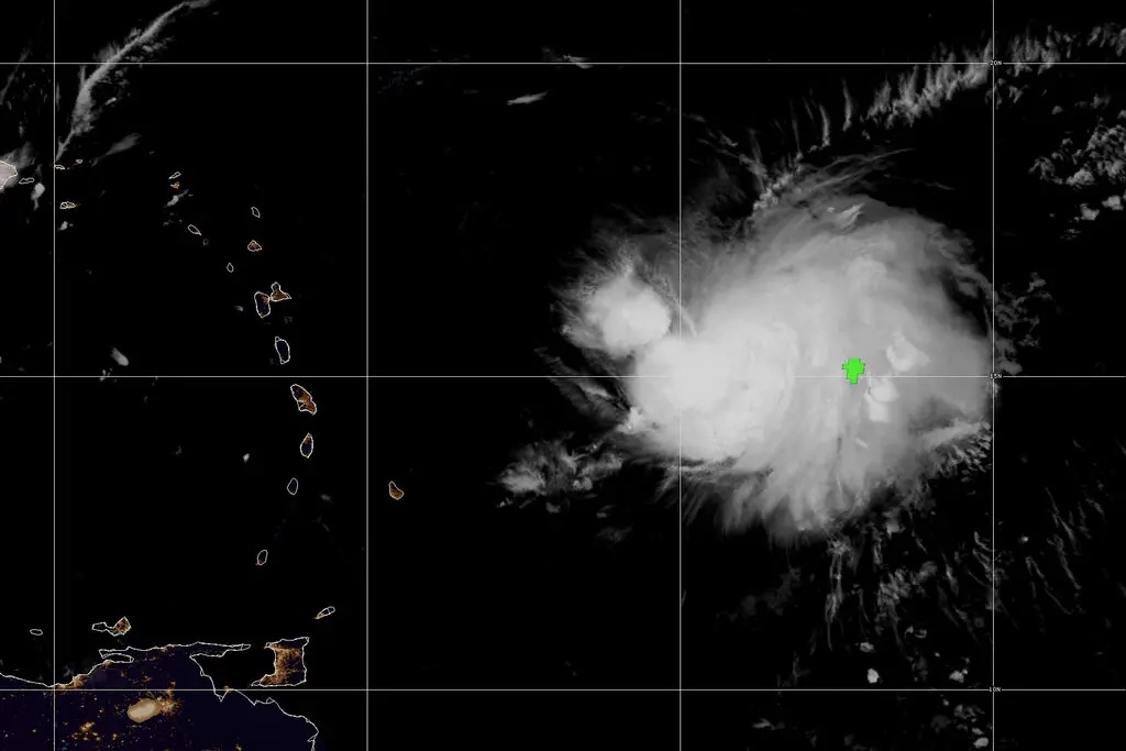
Tropical Storm Fiona was expected to bring high winds and up to six inches of rain to the eastern Caribbean starting Friday night, before moving near Puerto Rico and the Virgin Islands over the weekend, forecasters said.
Tropical storm warnings, meaning that tropical storm conditions are expected within the area in the next 36 hours, were issued for: Anguilla, Antigua, Barbuda, Guadeloupe, Montserrat, Saba, St. Barthélemy, St. Eustatius, St. Kitts and Nevis, and St. Maarten/St. Martin.
Tropical storm watches — meaning that tropical storm conditions are possible, generally within 48 hours — were issued for Puerto Rico, the U.S. Virgin Islands and the British Virgin Islands.
The storm was expected to strengthen slightly in the coming days, the National Hurricane Center said.
The storm was also expected to bring a considerable amount of rain across the region. Up to six inches with isolated higher amounts was forecast for the northern Leeward Islands, the British and U.S. Virgin Islands, with a maximum of 10 inches falling across eastern Puerto Rico and up to 12 inches in eastern Hispaniola, forecasters said, adding that rains could produce flash flooding and create mudslides.
As of early Friday, the storm was about 265 miles east-southeast of the Leeward Islands in the eastern Caribbean. It was moving west at 15 miles per hour, with maximum sustained winds of 50 m.p.h., according to the Hurricane Center.
Tropical-storm-force winds extended outward up to 125 miles from the center.
The Atlantic hurricane season, which runs from June through November, had a relatively quiet start, with only three named storms before September. There were no named storms in the Atlantic during August, the first time that had happened since 1997. But storm activity picked up in early September, with Danielle and Earl, which both eventually became hurricanes, forming within a day of each other.
In early August, scientists at the National Oceanic and Atmospheric Administration issued an updated forecast for the rest of the season, which still called for an above-normal level of activity. In it, they predicted the season could see 14 to 20 named storms, with six to 10 turning into hurricanes that sustain winds of at least 74 m.p.h. Three to five of those could strengthen into what the agency calls major hurricanes — Category 3 or stronger — with winds of at least 111 m.p.h.
Last year, there were 21 named storms, after a record-breaking 30 in 2020. For the past two years, meteorologists have exhausted the list of names used to identify storms during the Atlantic hurricane season, an occurrence that has happened only one other time, in 2005.
The links between hurricanes and climate change have become clearer with each passing year. Data shows that hurricanes have become stronger worldwide during the past four decades. A warming planet can expect stronger hurricanes over time and a higher incidence of the most powerful storms — though the overall number of storms could drop, because factors like stronger wind shear could keep weaker storms from forming.
Hurricanes are also becoming wetter because of more water vapor in the warmer atmosphere; scientists have suggested storms like Hurricane Harvey in 2017 produced far more rain than they would have without the human effects on climate. Also, rising sea levels are contributing to higher storm surge — the most destructive element of tropical cyclones.


